


High-resolution maps for print products.
Sharp, print-ready maps for brochures, photo books, mailings and travel reports. Your system can create a different map for every page or every recipient, in print quality of 150 or 300 dpi.
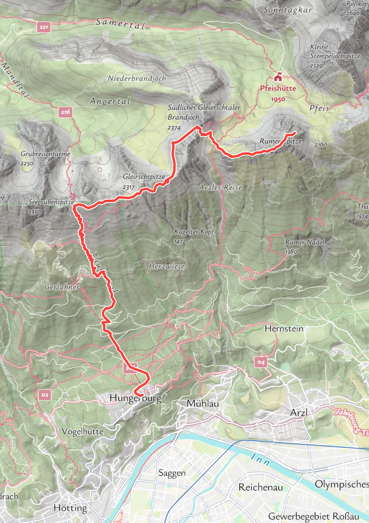
Sharp enough for paper.
The same corner of a hiking map, shown at the same size: as a screen map, and at the two print qualities. At 300 dpi, labels and lines stay crisp on paper.
Screen quality
Fine on a screen, blurry on paper.
Print, 150 dpi
Twice the detail, for everyday prints.
Print, 300 dpi
Four times the detail, for high-quality print.
One-off maps, designed by hand.
For single maps made by hand, printmaps.net is a self-serve editor with export to layered PSD, SVG and PNG. The editor is also available as a white-label integration.
Same request as the Static Maps API.
A print map is requested like a static map image: place, size, style and what to draw. One extra setting, the ratio, makes it print quality.
https://staticmap.maptoolkit.net/
?style=maptoolkit-maptoolkit.hiking
¢er=47.3045,11.4065
&zoom=13.5
&size=620x877
&ratio=4
&format=png
&api_key=YOUR_API_KEYThis request returns the hiking map at the top of the page: an A4 page at 300 dpi (2480 x 3508 px).
150 or 300 dpi
ratio=2 gives 150 dpi, ratio=4 gives 300 dpi.
PNG, JPEG or WebP
The file format your print workflow needs (format).
Seven map styles
Summer, Winter, Hiking, Cycling, Street, Light and Dark. Custom map styles are available with Enterprise.
Your places and routes
Markers and routes sent with the request, and areas from a KML file.
A map for every recipient.
Each request returns one finished map, so a print run can carry a different map on every page or letter.

Questions about print maps.
Short answers on file formats, your own map style and fitting a route onto the page.
Can the Printmaps API deliver a vector file such as SVG or PDF?
No. The Printmaps API returns finished images in PNG, JPEG or WebP, at 150 or 300 dpi, which you can place in your layout or print workflow. If you need a map you can keep editing, use the printmaps.net editor instead. It exports a single map as a layered PSD, an SVG or a PNG file, made by hand rather than by your system.
Can I print maps in my own map style?
Yes, with an Enterprise plan. Custom map styles are available to Enterprise customers, and the Printmaps API supports them like the standard styles. Without a custom style, you choose one of the seven standard styles: Summer, Winter, Hiking, Cycling, Street, Light or Dark. Your markers, routes and areas are drawn on top of the style you pick.
How do I fit a whole route onto the page?
Instead of a center point and a zoom level, send the bounds of the area the route covers. The API then fits the map to that area and works out the zoom level for you. If the route sits too close to the edge, use delta_zoom to shift the calculated zoom level, which gives you more or less space around it.
See your use case on a Maptoolkit map.
In the demo, one of our engineers walks you through the platform, your data and the move from your current provider.