


From address to map.
Turn what people type into a place on the map, and a place on the map back into an address. Anywhere in the world, in the language you choose.
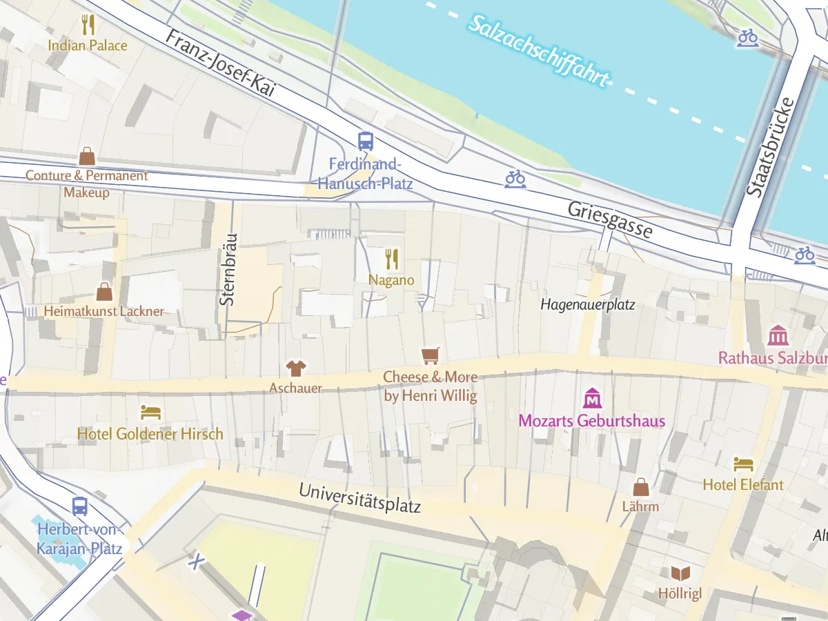
Type a place, get a position.
Addresses, landmarks, mountains and towns anywhere in the world, with names in the language you ask for, and coordinates turned back into an address. With Maptoolkit Enterprise your own places appear in the results too, connected through Maptoolkit Connectors.
Real answers of the Geocoding API (October 2026), first result for each search.
Try the search.
Type an address, a landmark or a town anywhere in the world, or click the map to get the address there.
Type and pick a result
Click the map for the address at that point
Every way to find a place.
Search forwards or backwards, narrow the search down and get the answer the way your visitors need it:
Address from a point
Tap the map and get the address there, with the place name when there is one.
Search within a country
Limit results to countries or prefer an area, so Salzburg can also mean the village in the Westerwald.
Outlines of places
Ask for the outline of a town or region and show it on your map.
In your language
Names and addresses in the language your visitors read.
Know where your places are.
Send the position of each of your places and keep the town, district, state and country that come back. Then group your places, filter them by region or label them.
Here, 375 webcams in Tyrol and Salzburg from OpenStreetMap, sorted by district.
Two endpoints, plain JSON.
Search with /search, look up an address with /reverse. Results come from OpenStreetMap: streets are mapped well, house numbers are sometimes missing. Available with the self-service plans on RapidAPI and with Maptoolkit Enterprise.
const url = new URL("https://geocoder.maptoolkit.net/search");
url.search = new URLSearchParams({
  q: "Getreidegasse 9, Salzburg", language: "en", api_key: "YOUR_API_KEY",
});
const [first] = await (await fetch(url)).json();

// first.display_name: "Mozart's Birthplace, Salzburg, Austria"
// first.lat, first.lon: "47.7999430", "13.0435536"
// first.category: "poi"
The second result is the address itself: Getreidegasse 9, 5020 Salzburg.
Search and reverse
Text to places (/search, q), a position to its address (/reverse, lat and lon).
Language
German by default; ask for English names with language=en.
Countries and areas
Limit to countries (countrycodes=de,at) or prefer an area (viewbox).
Outlines
Add the outline of the place as GeoJSON (polygon=1).
Mind the order
Coordinates come as text; boundingbox is minLat, maxLat, minLng, maxLng, viewbox the other way.
One search per request
No batch requests; add your key to every request (api_key). Errors are plain text.
Where geocoding is used.
Wherever people search for a place or need an address. Three common examples, with real answers from the API:
Tourism portals
Visitors type a town or a region and the map shows them where it is.
Mobile apps
Show people the address of where they are standing, or of a point they tap.
Real estate
Put every listing on the map from its address alone.
Addresses and positions in these examples are Geocoding API results.
Questions about geocoding.
Short answers on address lists, Nominatim, search boxes and API keys.
Can I geocode a long list of addresses?
Yes, one address per request. There is no batch endpoint, so a list is sent as a series of requests, each with your API key. Every request counts toward the monthly quota of your plan. Enterprise plans have no request limit, which suits large one-time imports.
How does the Geocoding API compare to Nominatim?
The responses look like Nominatim’s, with the same fields for name, coordinates and bounding box, so existing code usually keeps working. On top of that, each result gets a category (place, address or point of interest), duplicates are removed and results are ranked by relevance. Results come in German unless you set a language.
Can I add a search box to a MapLibre or Leaflet map?
Yes. The documentation has working examples that connect the Geocoding API to the common search plugins for MapLibre GL JS and Leaflet. The plugin draws the search box, and the API finds the places. If the search runs while people type, wait for a short pause before sending the request, since every request counts toward your quota.
How do I get an API key?
Subscribe to one of the self-service plans on RapidAPI, from the free Basic plan to Ultra, and copy the key from your RapidAPI dashboard. With Maptoolkit Enterprise you get a Maptoolkit API key instead, which you can restrict to your own domains and apps in the Maptoolkit admin.
See your use case on a Maptoolkit map.
In the demo, one of our engineers walks you through the platform, your data and the move from your current provider.